We finally got some internet so I can share charts, way points and a few pictures with you.
I will put the technical details and way points on the charts themselves. If you want details, just zoom in and out on the charts and click on the ‘pins’ for more information.
This will hopefully save non-sailors from getting really, really bored.
THE FIRST STEP OF ANY PASSAGE IS PLANNING AND PREPARATION
Whatever route we took, to get down to the San Blas Islands of Panama, we knew we were going to be at sea for about 5 days. It is possible to break up the trip, and I will talk later about that.
PREPARATION
Preparing the boat to be ‘self sufficient’ for a long passage is important, especially if you think you may encounter some ‘brisk’ winds and rough seas.
For my humans, that means checking all essential systems. Engine, auto-helm, standing rigging and running rigging. Oil and coolant topped up. Raw and fuel filters checked and cleaned. Blocks and tackle all checked for loose pins and chafe. We were expecting possibly strong winds, so we fitted up the stay sail ready to go. This is also a better sail for us to hove-to with (stop the boat) if needed.
Then they got out all the safety equipment. All of it was checked over for corrosion. Jack stays fitted, safety lines clipped in place and life jackets out at hand. Wet weather gear was put ready at hand. All loose articles that could go overboard or become projectiles below were secured. The sea berth was set up in the saloon. (See page ‘About the boat’ for details)
Finally, everyone has to eat and drink water. My food box was topped up and secured in an easy access area. The humans always have a ‘no tip’ water bowl for me. The humans topped up water bottles in the fridge and made several small easy to digest meals that can be eaten cold or warm. To save room in the fridge, and decrease dishes needing cleaning, they were packed in individual zip lock bags. The humans had 4 small helpings each of:
-potato salad
-tuna macaroni salad with olive oil
-mixed veggie rice with toasted nuts
This saved time in the galley while they got their ‘sea legs’. We all take about 2 days to get our ‘sea legs’ on Spirit of Argo.
PLANNING
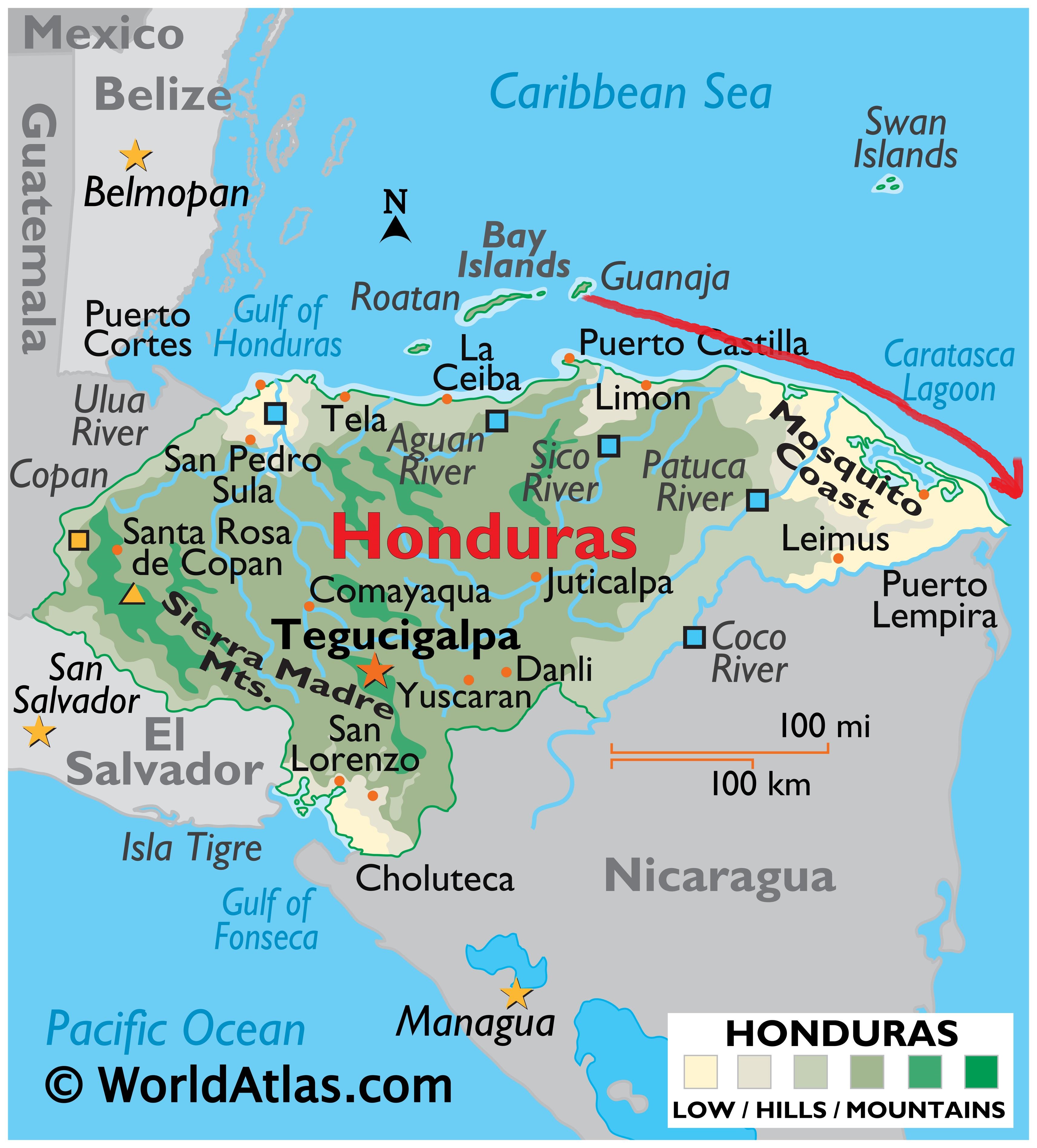
Planning a route in the Western Caribbean can be difficult. Most available charts are incomplete, incorrect or non-existent. Good quality, recently published, cruising guides and/or information is essential. My humans could find no cruising guide that covers the waters between Honduras and Panama. Information had to be gleaned from other cruisers that ‘had been there and done that’.
Suggested Route One
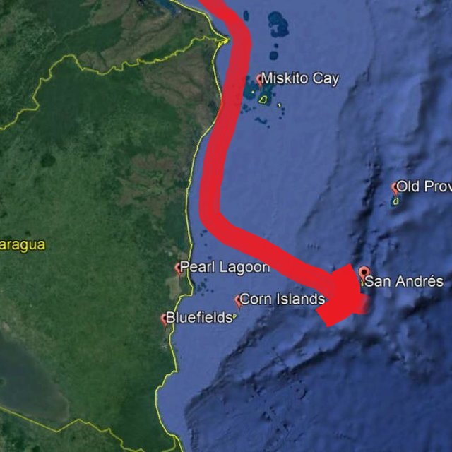
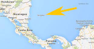
Jimmy Cornell’s ‘World Cruising Routes’ does suggest a route that runs due east, past the Vivorillo Cays, Hobbies, out to Gorda Bank and then turns south to Panama.
This route does give the sailor several opportunities to stop along the way. You have the Vivorillo Cays, the Hobbies, Providencia and San Andres islands to break up the trip.
Suggested Route Two
If you look on the charts there appears to be a channel running south, just below the Vivorillo Cays and the Hobbies. It is called the ‘Main Cape Channel’.
My humans could find little information on the route. What information they did find was not favourable. ‘Poorly charted reefs’ and ‘dangerous amount of shipping in a narrow channel’.
The Route they decided to take
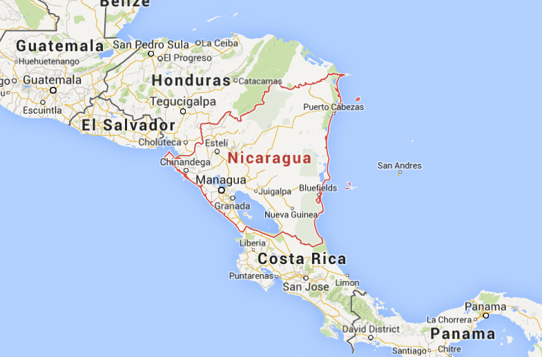
Two friends delivered a boat to Australia over the summer and they took a route closer to the shores of Nicaragua down the Miskito Channel.
Hoping to avoid ‘bashing’ straight into the east wind, the humans opted for this route. With the weather conditions we faced, and hearing the experience of friends that took the ‘Jimmy Cornell’ route, I think it was a wise choice.
About time these humans made some wise choices.
Heading out into strong winds and rough seas was not smart. But I do understand from the humans that the only way to get easterly, is to wait for a ‘front’ to push south and turn the winds more Northerly. You hope for a ‘mild’ front, but sometimes you just have to take what the weather gods throw at you. And they did ‘THROW IT AT US’ a bit.
SO HOW WAS THE PASSAGE
To sum up the trip. It started ‘adequate’ , then ‘could have been worse’. It ‘ got horrible’, ‘stayed horrible’ and then became ‘tolerable’. Do you really want to know the details????
ADEQUATE
The trip started out OK. The seas were still a little stirred up after the last blow and the winds still a little too easterly. We were heading more southerly, than friends taking the ‘Jimmy Cornel’ route, or those heading to the Vivorillo Cays. For this reason we got in a lot more sailing in then they did. We managed to catch and then lose three beautiful Mahi Mahi (fish). Darn!

Your author doing his morning yoga exercises
COULD HAVE BEEN WORSE
As we headed towards and eventually down the Miskito Channel we were well protected from the full force of the Caribbean Sea by the outlying reefs. We experienced some squalls with gusting winds, but the sea never built. The waters were shallow, only 20m deep. Our only companions were small pods of bottle nose dolphins and large shrimp and fishing boats leaving the mainland and heading out to sea.

GOT HORRIBLE
Once we left the Miskito Channel we were faced with the full brunt of the Caribbean Sea. Days of strong winds had built waves up to 3m. Driven by the wind onto the shallows surrounding the coast of Nicaragua, these waves became short and steep. Once we left this shallow shelf we started running into a lot of cargo ship traffic.

STAYED HORRIBLE
As we moved into deeper water the waves continued to build, but the distance between them increased (the period of a wave). Unfortunately the waves were coming in on our beam (from the side of the boat). This is not a comfortable point of sail for our boat to take rough seas at. Luckily most of the waves were not breaking. When they did sea spray would come crashing into the cockpit and/or the boat would get ‘bowled over’ badly. The biggest danger was objects getting dislodged below and becoming projectiles. The humans were pretty good now at securing things below, so there were few incidences.

The only time it got ‘a bit’ dangerous was when a squall came through. Towering columns of clouds would come rushing at us. They would bring down drafts of screaming winds and torrential rains. During the day light hours you could see them coming at you and reef in all the sails waiting for them to hit. At night it was a bit more difficult to predict them. It was also difficult to judge how bad each was going to be. Reef too early and you lose too much speed and can no longer steer the boat through the large waves. Reef too late and the boat and sails take a beating as you try to shorten them. Small squalls would pass quickly, but larger squalls would make the seas start to break. Now you would be beaten by both salt and fresh water at the same time!
We could hear the SSB weather forecasts and there was no mention of squalls in the area. We were battered constantly for two days. We had a few ‘hairy’ moments, but generally faired OK. Unfortunately friends, sailing at the same time as us, shredded their genoa . Luckily they had a good sturdy stay sail as a backup. The humans had to hove-to (stop the boat) between squalls to give me some ‘dog’ time.
TOLERABLE
On the last day the squalls finally abated. The wind speed decreased to a ‘manageable’ strength. The seas were still very large, but their surface had become smooth and rounded. The occasional rouge wave would come by. A goliath! You would see this huge mountain of water 4 or 5 meters high coming at you and you would just be in awe. The boat would rise up and up and up and you could see the seas around you for miles. Thankfully none of these monsters broke.

The amount of shipping on route was a problem. Taking aversive action in ‘brisk’ conditions is not so easy. AIS is helpful, but with the big seas we found it was not picking up a signal until cargo ships were less than 5 nautical miles away. We did not have a transponder, so the cargo ships had an even harder time picking us up on radar. We had to keep a careful watch. If we picked anything up we got into the habit of calling the ships up right away and informing them we were out there. Only once did we have to take action when we got no response. All the other ships were pleased to be notified we were out there, our position, speed and course. Many went ‘out of their way’ to give us lots of ‘sea room’.
WE MADE IT TO THE SAN BLAS ISLANDS

We were overjoyed to see the lovely palm fringed islands backed by the mountains of the Panamanian mainland. Groups of boats seemed to be anchored in the middle of ‘no where’ just off these tiny sandy cays. When you look at the charts you realise they are in fact totally surrounded by rings of reefs.
It was Sunday and officials in Panama do not work on Sundays. We needed to wait a day to check into the country. The anchorage on the south west side of Chichima Cay was suggested to us. We had planned to stop into the main anchorage, but we were warned that it could be very crowded, and after a long trip, the south west anchorage was quieter and easier to get into with any light.


CHECK IN
We sailed across the San Blas Channel to Isla Porvenir to check into Panama.
The only hazard getting to this island is Sail Rock. This submerged reef system makes you do a little twisting and turning to get inside the anchorage. It is a wide entrance, and clearly seen in the morning and noon light, but many boats run aground here every year.

‘Huts’ of the officials are located on the west (left) side of the island along with dingy docks.

‘Huts’ of the officials
Costs of checking? Click on the chart pin for details.
ALTERNATIVE ANCHORAGE AND SUPPIES
Half a mile south of Porvenir is the tiny inhabited islands of Wichubhuata and Nalunega. The anchorage on the south side of these islands is easy to get into and a lot less rolly than the one at Porvenir.

We took the dingy over first, but then moved the big boat when we heard fresh fruits and vegetables were arriving by boat in the evening from the mainland.

This was our first Kuna villages.
KUNA
The islands of San Blas are inhabited by the Kuna Indians. They have their own culture and traditions separate from Panama, and are self governing. Kuna Yala is a matrilineal society. The women control the money and the husbands move into the women’s family compound. Traditional villages are picturesque, clean and blend into the surrounding landscape. The huts are made of natural materials. Cane walls and palm roofs. Most family compounds have their own well. Each village has two oversized huts, the congreso and the chichi. The congreso is like a town hall, where the entire village meets most evenings. It is here that all important decisions are made by the Sailas (chiefs who hold the historical songs and knowledge)and the Argars (interpreters who translate this to apply to daily problems). The congreso is used for rituals and festivals.
*There is a lot of information on Kuna history and traditions available on line if you want to learn more.
We found the villages here very clean and friendly. We were lucky enough to run into a local (Eric) who was happy to interpret for us. The majority of locals speak both Kuna and Spanish. The villages here are used to visits from cruisers looking for supplies. For this reason you will find fuel, canned and dry goods, fresh baked bread and even some fresh fruits and vegetables, depending on the day of the week. Fresh supplies come into the islands by boat from the mainland once a week. Remarkably we were even able to purchase SIM cards and internet time. Reception is good here. NO BANKS. The only banks are back on the mainland, so bring whatever American dollars (small denominations) you think you will need during your visit.
The main village docks are concrete, so bring a dingy anchor or fender. There are a couple of wooden docks and everyone seemed happy for us to use them instead. The locals appreciate modesty, so cover up.
WHERE TO FROM HERE
We have very little on our schedule and are free to roam. There are hundreds of islands to explore along this coastline, stretching all the way to Columbia. We will do our best to visit as much of the area as we can for the remainder of the season.
Although Panama is free of hurricanes, it still has a rainy season. We have heard that it can get very damp and depressing here in the summer. Also the lightning storms can be violent and frequent. We will probably scoot northwest to the Bocas del Toro area of Panama during this time. It is either that or we make friends with a ‘big ass’ catamaran and ‘park’ next to them. We hear they make great lightning rods.
When we can get internet we will send you photos and updates.


4 thoughts on “Passage – Guanaja, Honduras to Porvenir, Panama – Summary, charts and pictures”
The waves sounded rather big! But you can now enjoy the San Blas Islands.
Now we are in the group of islands know as the San Blas Islands it is all protected waters and easy day sails. LOVELY JUBELY.
Well done guys, that sounded a tad scary to me. Those waves would have made me chunder over the sides, that’s for sure.
Looks gorgeous where you are and I hope Quinny gets a good leg stretch.
Hope you are well on the mend Cain and April keep up the good work on the blog.
Laters xx
Tony Laura Gemma Harry and maisie
Thanks Tony!
Got some more fun pictures for you, but the internet is so slow where we are I can not ‘up load’ them. You will just have to be patient. Heading towards the mainland in the week. I will try to forward them all then. All the best!
Love Quinnster