Position: We are hanging out just off the island of Fatu Hiva, Marquesas, French Polynesia. I will explain why in a moment. Our position is:
10 11.26S 137 36.83W
*Note: I am told you can copy and paste these coordinates into google earth and it will show you where we are.
Mileage: 159 – 66nm = 93nm
Number of miles to go: 66 nm to go of approx. 3850nm. We are almost there.
Fish count: The count remains the same. 4 Mahi Mahi, 2 Cero and 6 tuna. One Marlin that we were happy got away! We are going to put the fishing rods out tomorrow when we increase our speed and come round the island to the anchorage. Hopefully we get something nice for dinner!
GOOD THINGS COME TO THOSE THAT WAIT
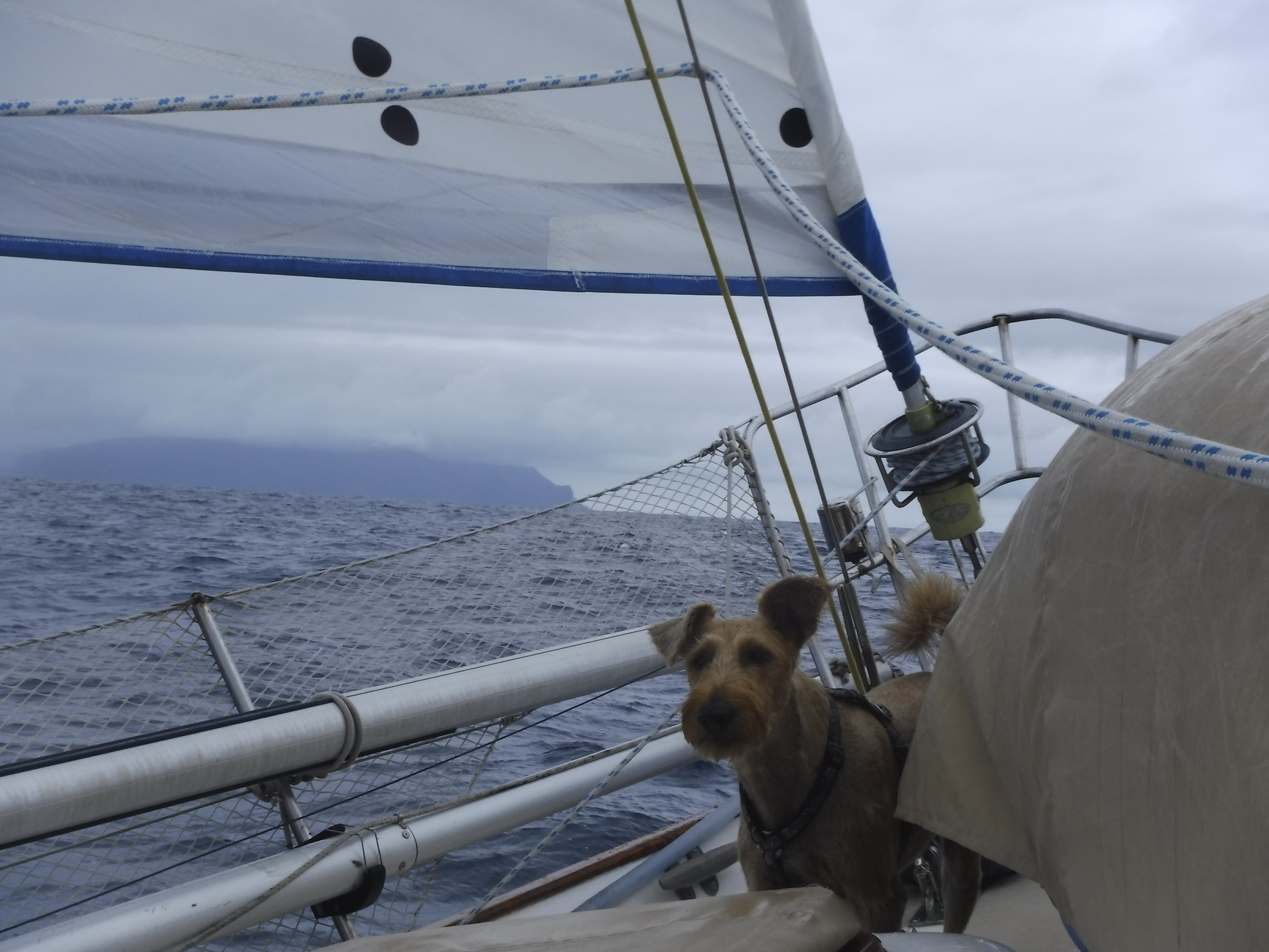
The winds started to ease yesterday after I wrote you. I can not complain too much as the seas became the calmest we have had yet. I was even able to get out and play on the deck. No more waves breaking on the boat and the humans were able to open up the hatches and air the boat out. Only one problem…..this meant the boat slowed down. Normally not a issue, but this close to our landfall, it becomes one.
ENTERING AN UNKNOWN ANCHORAGE AT NIGHT
As we watched the boat slow down the humans had to start accepting that they were not going to get to the anchorage before dark today. The anchorage they were aiming for has no reef or out lying dangers on the approach, but it is still a little dangerous to try and anchor up in a place with no prior knowledge at night. There is no moon tonight, so in the pitch darkness it is hard to judge distances to the shore or other boats already anchored there. Any unlit vessels or obstructions would be impossible to see. The safest option, after almost 5 weeks at sea, is to hold off and make port the following day in light.
BETTER SAFE THAN SORRY
No one likes to spend another night at sea when a port is so close. But the humans have learned that charts do not always line up with GPS coordinates, and without a moon, it would be better to be safe rather than sorry. The humans need to keep the boat away from the island for 12 more hours so they furled in all, but a small piece, of the head sail and been coasting slowly (2.5-3.5 knots)since the wee hours this morning. Just enough speed to be able to steer. When the sun comes up tomorrow, we can pull all the sails out again and put some speed back on. Better for fishing to go fast! Maybe we will get something good to go with those cold beers. What is one more night at sea?
SORTING THE BOAT OUT
The humans have been busy bees cleaning up inside the boat today. They have been giving the place a ‘spit and polish’ so they can go off exploring when we arrive. We still have some repairs to do and more laundry, but at least the cleaning is done. Now that the sea state is settled it is much easier. It has also been the hottest day yet, hitting 30*C. I, and one of the humans, have gotten pretty ‘hairy’ during this long trip. I will have to send you a picture of our matching beards. We are both determined not to shave until we hit port. Only one day away.
BAY OF VIRGINS (BAIE HANAVAVE/ BAIE DES VIERGES)
Our first port of call after the Pacific Passage. This incredibly beautiful bay lies at the Northwestern end of the island. The rocky spires near the head of the bay are the most noticeable feature. On either side and beyond are dark green cloaked, steep-sided mountains crating a spectacular view that is made more dramatic when highlighted by the setting sun. It has a 0.5 mile wide opening which narrows to a beach a the head of the bay. The bottom is steeply sloping and subject to swells and gusty winds sweeping down the steep slopes of the mountains.
The bay is entered by lining up a steep pinnacle rock on the north side with a whitish peak halfway up the slope behind. Sail boats can then proceed toward the head of the bay to anchor in good holding mud and sand. At the north end of the beach is the village of Hanavave, where landing can be made at the concrete wharf at the north end of the bay. A breakwater protects the wharf making it an easy landing place. The village is famous for its many graceful outrigger canoes which are used for fishing and visiting Baie d’Omoa, the next village south.
About an hours walk behind the village, is a spectacular 200-foot waterfall, or you may take a hike to Omoa, about 10 miles distance, which takes 4-5 hours. Along the way orchards of cashew trees and noni plantations can be seen. Beyond the highest part of the trail and when in season, waterfall mangoes provide a tasty snack. Look for them where the road is covered with a blanket of dried mango seeds.
REFERENCE MATERIAL
Charlie’s Charts of Polynesia, Charles and Margo Wood, http://www.charliescharts.com
The Marquesas Compendium, Free PDF by s/v Soggy Paws, http://svsoggypaws.com/files/#pacific
END


